۱۳۹۰ مهر ۳, یکشنبه

خشکسالی در خاور قاره ی آفریقا Drought in East Africa


East Africa is about as far from the Central Pacific Ocean as a person can get without leaving the planet. And yet, as the Pacific chills, drought grips East Africa in classic La Niña style. Because of global teleconnections, La Niña has to power to affect the weather half a world away.
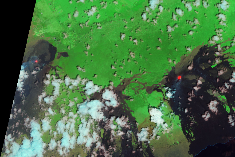
This image, from France’s SPOT satellite, shows severe drought in Somalia, Kenya, and southern Ethiopia. The image is a vegetation anomaly, a measure of how well plants were growing compared to average. This image compares plant growth between January 1 and 10, 2011, compared to the average growth for January between 1999 and 2009. Widespread brown is an indication that plant growth slowed, with fewer photosynthesizing leaves than average.
A typical December in much of East Africa is rainy, the end of a 3-month rainy period before a dry stretch that usually lasts from January to March. In 2010, however, the rains were erratic and ended in early November. December was hot and dry. Two thirds of Somalia received less than 75 percent of normal rainfall, reported the UN-funded Somalia Water and Land Information Management program. Without rain, the pastureland and cropland in the region produced poor crops and little grass for livestock, leading to food shortages and livestock deaths, said the United Nations.
Poor or failed rainfall during the short rain growing season (October to December) is a classic La Niña signal. In late 2010, a strong La Niña cooled surface waters in the central and eastern Pacific Ocean, while allowing warmer water to build in the eastern Pacific. The pool of warm water in the east intensifies rains in Australia, the Philippines, and Indonesia. Domino-style, this pattern also increases the intensity of westerly winds over the Indian Ocean, pulling moisture away from East Africa toward Indonesia and Australia. The result? Drought over most of East Africa andfloods and lush vegetation in Australia and other parts of Southeast Asia.
1.   References
2.   Anyamba, A., Tucker, C.J., Mahoney, R. (2002). El Niño to La Niña vegetation response patterns over East and Southern Africa during 1997-2000 period. Journal of Climate, 15, 3096-3103.
3.   Ropelewski, C.F., Halpert, M.S. (1987) .Global and regional scale precipitation patterns associated with the El Niño/Southern Oscillation. Monthly Weather Review, 115, 1606-1626.
4.   Somalia Water and Land Information Management. (2011, January 17). Somalia drought watch. Published on ReliefWeb. Accessed January 19, 2011.
5.   United Nations Office for the Coordination of Humanitarian Affairs. (2011, January 13). La Niña drought response by sectors. Published on ReliefWeb. Accessed January 19, 2011.

۱۳۹۰ مهر ۲, شنبه

مه بر فراز دریاچه ی بایکا ل Fog over Lake Baikal


Fog is essentially a cloud that exists near the Earth’s surface, and fog can form over land or water. On September 22, 2011, fog formed over Lake Baikal in southeastern Siberia, and the Moderate Resolution Imaging Spectroradiometer (MODIS) on NASA’s Aqua satellite captured this natural-color image the same day.
The fog almost perfectly mimics the lake’s area, only thinning at the southwestern end, and leaving a few parts of the water surface fog-free. When cold air flows over warm water, some surface water evaporates into the cold air and saturates it, raising its relative humidity to 100 percent. The phenomenon is alternately known as evaporation fog, steam fog, even sea smoke, explains Michael Pidwirny of the University of British Columbia. Meteorologists define the existence of fog as visibility of less than 1 kilometer (0.6 miles) at ground level.
Lake Baikal is 25 million years old and about 1,700 meters (5,600 feet) deep, making it the world’s oldest and deepest lake. It holds about 20 percent of Earth’s unfrozen fresh water, according to the United Nations Educational, Scientific and Cultural Organization (UNESCO). The lake is a UNESCO World Heritage Site.
1.   References
2.   Pidwirny, M. (2008, June 19). Precipitation and fog. The Encyclopedia of Earth. Accessed September 23, 2011.
3.   World Heritage. (2011). Lake Baikal. UNESCO. Accessed September 23, 2011.

گرد وغبار درباختر آفریقا Dust off Western Africa


Dust plumes blew off the west coast of Africa and over the Atlantic Ocean in late September 2011. The Moderate Resolution Imaging Spectroradiometer (MODIS) on NASA’s Terra satellite captured this natural-color image on September 23, 2011.
The dust plumes sport a wave-like appearance—bands of thick dust alternating with bands of relatively clear air. Some waves extend westward while others curve toward the south in giant arcs. At the end of one curving wave of dust, a line of clouds extends southward over the sea. These ribbon-like patterns might result from atmospheric waves.
Sand seas sprawl over much of Mauritania, and the abundant sand provides plentiful material for dust storms. This dust storm has not yet reached Cape Verde, which lies to the southwest, but the dust appears headed in that general direction.
1.   References
2.   Haynes, J. (2009, July 20). Weather: Avoiding Turbulence. NASA Science. Accessed September 23, 2011.

۱۳۹۰ شهریور ۳۰, چهارشنبه

شکل چرخشی رودخانه به سبب برخورد شهابسنگ The Wembo-Nyama Feature - Democratic Republic of Congo


This circular feature could be one of the largest asteroid impact sites on Earth
 

What Earth Processes Produce Circular Features?


In the center of the Democratic Republic of Congo, the Unia River flows around a circular structure known as the Wembo-Nyama feature. Several things in nature leave a circular footprint such as this, including volcanoes and uplifted domes. However, Italian scientists from the University of Padova believe that the Wembo-Nyama feature is an impact crater. If the 36–46-kilometer-wide feature is a crater, it is among the largest in the world. 

فوران های آتشفشان ِ " رابا ل " Rabaul Volcano Erupts (in 1999)


An ash plume rises from Tavurvur Volcano (part of the Rabaul Volcanic Complex) on November 19, 1999. NASA/USGS Landsat 7.
There are some amazing things buried in the archive, like this natural-color image of an eruption at Rabaul. According to the Global Volcanism Program the activity at the time was “continuous, forceful emissions of thick, light-to-dark gray ash cloud

آتشفشا ن " نابرو " وآتش سوزی Nabro Volcano and Texas Wildifres


This long-dormant Eritrean volcano began erupting in June, but it’s so remote (at least for western media and scientists) that there’s been no news from the area for months. Unfortunately it’s often been cloudy, so we haven’t gotten any good satellite imagery, either. The best recent imagery is this false-color image (vegetation is red), which shows activity has ceased, although there may be a slight hint of gas emissions near the vent. We’re still trying for better imagery, and will post anything we get in our Volcanoes and Earthquakes

جریان گدازه در آتشفشان " کیزی من " Lava Flow on Kizimen Volcano


A prominent lava flow descends the eastern flank of Kamchatka’s Kizimen Volcano in this false-color satellite image acquired on September 5, 2011 (top). An image of the peak from September 6, 2009 (lower), shows the extent of the changes that have occurred since Kizimen began erupting in late 2010.
Volcanic deposits (colored brown) have covered much of the vegetation (red) on the slopes of the volcano, especially to the east. Likewise, material has filled rivers and streams around the volcano. A modest volcanic plume rises from Kizimen’s summit, accompanied by a smaller plume from a fumarole to the northwest.
These images illustrate the growth of a stratovolcano: layers of lava flows alternate with layers of “volcanic ash, cinders, blocks, and bombs.” Unlike fluid hawaiian-style lava, the flow on Kizimen is a block-lava flow, so viscous it’s almost solid. As the flow slowly advances down the east side of the volcano, the surface crumbles, sending boulders, rocks, pebbles, and other material tumbling into the valley below.
In less than a year, this rubble piled high enough to block several drainages, and a new lake was formed. Ash and fine sediment color the lake brilliant blue, in contrast to the nearly black shade of the lake in 2009. Famous stratovolcanoes include Mount St. Helens, Mount Fuji, and Popocatepetl.
These images were acquired by the Advanced Spaceborne Thermal Emission and Reflection Radiometer (ASTER) aboard the Terra satellite.
1.   references
2.   Global Volcanism Program. (2011, September 7). Kizimen: Weekly Reports. Accessed September 12, 2011.
3.   Kamchatka Volcanic Eruption Response Team. (2011, September 8). Kamchatkan and Northern Kuriles Volcanoes.Accessed September 12, 2011.
4.   USGS Cascades Volcano Observatory. (2005, October 5). DESCRIPTION: Composite Volcanoes and Stratovolcanoes, Subduction-Zone Volcanoes.Accessed September 12, 2011.

۱۳۹۰ شهریور ۲۸, دوشنبه

منطقه ی پیرامون هسته ی اتمی ستاره ی دنباله دار " هیاکیوتک "


 The Region Around the Nucleus of Comet Hyakutake

تابش خورشید پراکنده شده بوسیله ی گرد و غبار در خواب آلودگی ِِستاره ی دنباله دار " هیاکیو تک"


Sunlight Scattered By Dust in Coma of Comet Hyakutake

پرتو فرابنفش از اتم های هیدروژنِ ِ در خواب آلودگی ِ ستاره ی دنباله دار " هیا کیوتک"


Ultraviolet Radiation From Hydrogen Atoms in Coma of Comet Hyakutake


۱۳۹۰ شهریور ۲۳, چهارشنبه

دریاچه ی آرال در سال 2011 Aral Sea 2011


Jewel-like green against the desert of central Asia, the Aral Sea has a long history of change. Over thousands of years, the lake has filled and dried, its fate linked to the flow of the rivers that feed it, particularly the Amu Darya. Since 1960, local rivers have been diverted in large-scale agricultural projects, and the Aral Sea has lost 90 percent of its volume.
Once the world’s fourth largest lake, the rapidly shrinking Aral Sea has fragmented into four bodies of water: the Northern Aral Sea, the eastern and western basins of the Southern Aral Sea, and Tsche-Bas Gulf. Of these, the eastern basin of the Southern Aral Sea and Tsche-Bas Gulf show the most dramatic change in 2011.
The Moderate Resolution Imaging Spectroradiometer (MODIS) on the Terra satellite acquired these images above on August 15, 2011, and August 26, 2010. The 2011 view is the latest addition to the World of Change series, which includes annual images since 2000. (You may also view the images overlaid on each other by clicking on "View Image Comparison." Learn more about this tool here.)
Of the remaining segments of the sea, the eastern basin of the Southern Sea is the most shallow. Fed primarily by the Amu Darya (darya means river), the basin all but disappeared in 2009 after four years of drought slowed and eventually stopped the river flow. In 2010, the drought broke and water swelled the eastern basin once again. But in 2011, less water entered the basin. Water levels in this image are lower than any previous year except 2009.
The image shows other signs of a drier year in 2011. The Amu Darya delta contains far less water than in 2010, and the Tsche-Bas Gulf is much smaller. Cut off from the Southern Aral Sea by a dam, the Northern Sea is more stable, but still shrank in 2011 compared to 2010.
Even if efforts were made to restore the Southern Aral Sea, it is unlikely that the it could recover in the near term. More than 50 percent of the flow of the Amu Darya would have to enter the southern Aral Sea to bring it back to life. This water, however, is needed to grow crops to feed the populations of Uzbekistan, Turkmenistan, Kazakhstan, Afghanistan, and Tajikistan. While improvements in irrigation efficiency could restore some water to the sea, it would not be enough for a full recovery.
The Aral Sea is equally unlikely to dry up entirely, argues Philip Micklin, a geographer who has been studying the Aral Sea for decades. The sea still gets water from rain and snowmelt, irrigation runoff, and ground water. As demonstrated from 2010 to 2011, year-to-year fluctuations in rain and snow will likely have a big influence on the sea’s extent, particularly in the shallow eastern basin.
1.   Reference
2.   Micklin, P. (2006, November 27). The Aral Sea disaster. Annual Review of Earth and Planetary Sciences, 35: 47-72. Accessed September 1, 201


جریا ن های کدازه ای تازه در دهانه ی " پو یو او" Fresh Lava Flows at Pu’u O’o


Although Kilauea Volcano has been erupting continuously for more than 25 years, the activity is anything but steady. From time to time, the flow of magma beneath the volcano shifts, causing old vents to close and new ones to open. From March—when lava fountains briefly appeared at the Kamoamoa Vents—until early August, most of Kilauea’s fresh lava was confined to a lava lake within Pu’u O’o crater.
On the afternoon of August 3, 2011, lava broke out 700 meters to the west of Pu’u O’o, followed shortly by a partial collapse of the crater and rapid draining of the lava lake. The activity formed two lava flows: one halfway between Pu’u O’o and the Kamoamoa Fissures, and another directly south of the crater. Within weeks, the western flow had slowed to a trickle, and the lake within Pu’u O’o began to refill. Intense heat from the lava lake causes Pu’u O’o to appear bright red in a false-color view of Kilauea.
This natural-color satellite image from the Advanced Land Imager (ALI) aboard the Earth Observing-1 (EO-1) satellite shows Pu’u O’o Crater and the surrounding area on September 7, 2011. The freshest lava flows are nearly black, contrasting with older flows that turn brown as they age. The oldest flows are covered with green ohia forest. Downwind of Pu’u O’o (south-southwest), persistent volcanic gas emissions have lightened the lava surfaces.
1.   Reference
2.   USGS Hawaii Volcano Observatory. (2011, August 3). Hawaiian Volcano Observatory Information Statement. Accessed September 8, 2011.